
The Metro Effect: How Much of Bengaluru Does Namma Metro Cover?
Bengaluru has officially become the world's second most congested city. With the Yellow Line inauguration, we analysed exactly how many residents are now within reach of a metro station.
Bengaluru and traffic are a legendary duo. Bengaluru has officially moved up to become the world's second most congested city, trailing only Mexico City. This is a drop from 6th place just 3 years ago. For the average commuter, the "traffic tax" in Bengaluru is now equivalent to a full week of their life every year. The average person lost 168 hours and 40 minutes to rush-hour traffic in 2025. This is an increase of nearly 13 hours compared to 2024. Bengaluru added nearly 59,000 private vehicles in August 2025 alone. A mega city which drives more than half of Karnataka GDP and Tax collection, needs serious mass public transit.
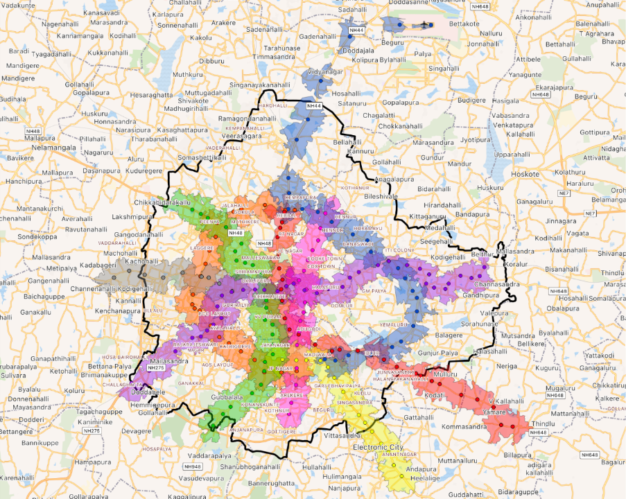
With the inauguration of the Yellow Line, the city's transit landscape has reached a significant milestone. At Latlong, we analyzed the data to see exactly how much of the city is moving closer to a station.
Using a 2 km catchment area (the distance residents are willing to travel to reach a station), here is how the expansion of Namma Metro is changing the way Bengaluru breathes.
The Immediate Impact: 33% to 40%
Before the Yellow Line, the existing Purple and Green lines covered approximately 33% of Bengaluru's residents. With the addition of the Yellow Line, that coverage jumps to 40%.
This isn't just a number on a spreadsheet; it represents a massive relief for the southern part of the city. Residents can now bypass some of the city's most notorious bottlenecks to reach major work hubs in Electronic City and Bommasandra.
The Roadmap to 2029: Major Milestones
While the Yellow Line is a win, large parts of the city remain "metro-dry." However, the data shows a clear path toward a more connected city:
The Pink Line (Late 2026), running North-South from Kalena Agrahara to Nagavara, is the tipping point — once operational, half of all Bengaluru residents will live within 2 km of a metro station. The Blue Line (Early 2027) will tackle the infamous Silk Board to K.R. Puram stretch, moving total coverage to 56%. By 2029, Phase 3 completion of the Orange, Grey, and Red lines will cover 72% of residents.
By the Numbers: Population & Coverage
- Purple + Green: 2.90 Million residents (33%)
- Adding Yellow Line (Current): 3.45 Million (40%)
- Adding Pink Line: 4.30 Million (50%)
- Adding Blue Line: 4.90 Million (56%)
- Phase 3 Full Network: 6.26 Million (72%)
More tracks and more frequent trains mean more than just convenience — they mean reclaimed time. The goal is to ensure 70% of the city's population is within influence zone of a metro station by 2031.
Is your neighborhood next in line? At latlong.ai, we go beyond the maps to provide deep-dive geospatial analytics. Whether you are a real estate developer looking for the next high-yield micro-market or a retail chain optimizing your next 50 store locations, our catchment data provides the precision you need.

Put location to work.
See how latlong.ai products fit your team. Book a 30-minute walkthrough with our solutions team.